
Emergency marker system installed for Lake Hickory Trails
When reporting an emergency, the dispatcher will ask for the address or location of the emergency. But what if you are on a hiking or mountain bike trail and need to report an emergency?
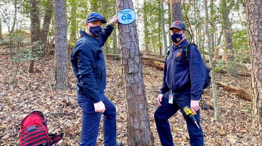
With over 8 miles of trails making up the Lake Hickory Trails system between Hickory City Park and Rotary-Geitner Park, emergency responders may have a difficult time finding you quickly. That is why Hickory firefighters developed a network of trail markers to aid with navigation. Similar to when you’re driving on the interstate, these signs serve as “mile markers” to provide situational awareness along the Broyhill Trail and Springs Loop of the Lake Hickory Trails.
GPS coordinates of each marker have been loaded into the City’s Geographic Information System (GIS), and firefighters can access the data utilizing their tablets or phones while out in the field. To aid in locating 911 callers, the coordinates have been shared with the Catawba County 911 Center. Markers are located approximately every 1/10 of a mile, which will increase the opportunity for accurate information when placing the emergency call.
Hickory Fire Chief Matt Hutchinson stated, “I am very proud of coworkers from Public Works and Sign Systems Incorporated who designed and fabricated the signs and the firefighters who handled the installation. Since the lack of landmarks can disorient even the most attentive trail users, this program will allow first responders the ability to quickly locate 911 callers on the trails when needed.”